The oil and gas industry operates some of the most geographically dispersed and physically demanding infrastructure in the world. Pipelines stretch across thousands of kilometers of terrain that ranges from accessible farmland to remote wilderness. Processing facilities combine elevated structures, pressurized vessels, and high-temperature equipment in configurations that present significant access challenges for conventional inspection methods. For an industry where infrastructure failure carries both catastrophic safety consequences and regulatory liability exposure, the quality and frequency of inspection programs directly determines operational risk.
Unmanned aerial vehicles have found a receptive market in oil and gas inspection not simply because they are cheaper than alternatives — though in many applications they are — but because they enable inspection modes that were previously impractical. A drone can inspect the upper surfaces of a floating roof storage tank without requiring the tank to be taken out of service. It can document the external condition of a flare tip 90 meters above grade without personnel exposure to elevated work risk. It can survey 40 kilometers of pipeline corridor in a single day without mobilizing a helicopter crew. These capability advantages, combined with favorable economics, have driven rapid adoption across the sector.
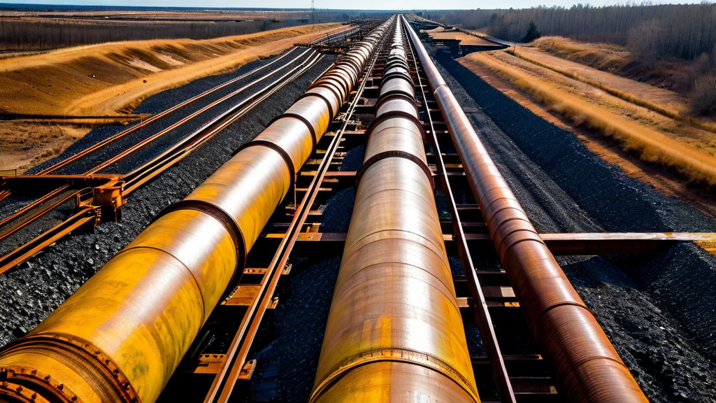
Pipeline Corridor Inspection
Aerial surveillance of transmission and gathering pipeline corridors is one of the oldest and most established applications of aviation in the oil and gas industry. Operators have used fixed-wing aircraft and helicopters for corridor patrol since the 1950s, primarily to detect right-of-way encroachments, erosion, third-party excavation activity near the pipeline, and gross leaks. The transition to UAV-based corridor surveillance is therefore not a new application but a technology upgrade to an established workflow.
The upgrade is substantial. Helicopter corridor surveys typically cover ground at 80 to 120 knots and capture imagery from an observer with binoculars or a handheld camera — a methodology that is effective for identifying large anomalies visible from several hundred feet of altitude but misses subtle corrosion, joint displacement, coating disbondment, or vegetation growth patterns that indicate subsurface pipe movement. A properly equipped industrial drone flying a corridor at 50 to 80 feet AGL and 15 to 25 knots captures imagery with sufficient ground sample distance to detect coating failures measuring 10 centimeters or less — an order of magnitude improvement in detection resolution.
The economics are equally compelling. A helicopter pipeline patrol covering 100 kilometers of corridor typically costs $18,000 to $25,000 when all direct costs are included. An equivalent survey with a two-drone, two-operator ground crew costs $3,500 to $6,000 depending on terrain complexity and mobilization distance. At that cost differential, operators who could previously only justify annual helicopter surveys can now afford quarterly or monthly UAV inspections, transforming their pipeline integrity management programs from annual snapshots to continuous monitoring.
Cost Comparison: Helicopter corridor survey (100km): $18,000–$25,000. Equivalent UAV survey: $3,500–$6,000. Cost reduction: 65–80%.
Thermal imaging payloads add a subsurface leakage detection capability to corridor surveys that is not available from visual inspection alone. Liquid hydrocarbon pipeline leaks typically create temperature anomalies in the soil column above the leak point due to the evaporative cooling effect of the escaping product. Drone-based thermal surveys conducted under appropriate environmental conditions — early morning, when soil surface temperature gradients are most stable — can detect subsurface thermal anomalies associated with active leaks that would be invisible to visual inspection.
Flare Stack and Elevated Structure Inspection
Flare stacks are among the most hazardous inspection subjects in the upstream oil and gas environment. A typical flare stack at a gas processing facility rises 60 to 120 meters above grade, exposing the tip hardware — combustion heads, pilots, flame detectors, and tip casing — to continuous thermal cycling, corrosive combustion byproducts, and wind loading that degrades these components over two to five year service intervals. Maintaining insight into tip condition is important for both reliability and emissions compliance, but accessing the tip for manual inspection has historically required either helicopter operation or scaffolding erection, both of which are expensive and the latter of which introduces significant working-at-height risk.
Industrial drones equipped with high-resolution zoom cameras and thermal imagers can complete a full external flare tip inspection in 30 to 45 minutes from ground level. The inspection covers visual documentation of tip geometry and casing condition, thermal assessment of combustion head hardware, and close-range imaging of pilot assemblies and flame detection equipment. The resulting dataset provides inspection quality that is comparable to or better than what a manual inspector can achieve from an aerial work platform — without any personnel exposure to the elevated work environment.
Refinery inspection extends drone utility to catalytic cracker towers, distillation columns, cooling tower structures, and pipe rack systems. The common thread across these applications is the elimination of the scaffolding and elevated access equipment that has historically been the largest cost component of structural inspection in processing facilities. A scaffolding erection sufficient to provide access to a 30-meter distillation column can cost $40,000 to $80,000 before any inspection work is performed. A drone inspection of the same structure typically costs $1,500 to $4,000, and the time from mobilization to final report is measured in days rather than weeks.
Floating Roof Tank Inspection
Floating roof storage tanks present a particularly interesting drone inspection application because of the in-service access advantage. Standard practice for thorough tank inspection requires taking the tank out of service, degassing, and cleaning — a process that costs $50,000 to $200,000 in lost storage capacity, cleaning labor, and safety monitoring for large crude oil or product storage tanks. Regulatory requirements typically mandate this full out-of-service inspection on five to ten year intervals, but operators have limited ability to assess condition between scheduled inspections without disturbing operations.
A drone operating above the floating roof can document roof condition — seal integrity, pontoon condition, drain system function, and structural distortion — without requiring any operational interruption. The UAV flies a systematic pattern over the roof surface at low altitude, capturing high-resolution imagery that reveals seal damage, standing water accumulation indicating blocked drains, and dimensional anomalies suggesting structural deformation. Thermal imaging adds a check for areas where liquid has infiltrated pontoon compartments, which would otherwise be detectable only during a full out-of-service inspection.
Gas Detection Integration
Optical gas imaging (OGI) camera technology — cameras that make normally invisible hydrocarbon gas plumes visible by imaging in the mid-infrared spectral band — has opened a new class of UAV inspection application: airborne fugitive emissions detection. Regulatory requirements for Leak Detection and Repair (LDAR) programs at gas processing and storage facilities create a recurring compliance cost that has historically been addressed by trained OGI camera operators walking inspection routes on foot, scanning valves, flanges, compressor seals, and other potential leak points.
Mounting an OGI camera on a UAV dramatically increases the coverage rate achievable per operator-hour. An experienced drone OGI operator can cover three to four times the number of potential leak points per shift compared to walking inspection, with the added benefit that the drone can access elevated or confined equipment locations that are difficult to inspect safely on foot. The regulatory acceptance of drone-based LDAR programs is advancing in parallel with the technology development, with the U.S. Environmental Protection Agency providing guidance on drone OGI as an alternative monitoring method under Method 21 and relevant parts of the oil and gas NSPS.
Offshore Platform Inspection
Offshore oil and gas platforms concentrate all the inspection challenges of onshore facilities into environments that are even more hostile and logistically complex. Marine atmospheric corrosion is more aggressive than most onshore environments, structural access requires overwater personnel positioning that creates significant dropped-object and fall risk, and the cost of offshore helicopter mobilization is high enough that inspection frequency is almost always limited by economic constraints rather than technical needs.
Offshore UAV inspection programs address these constraints by deploying drones from the platform deck to inspect platform legs, jackets, risers, and topside structures under remote operator control. The operational environment is challenging — salt spray, platform turbulence, and the proximity of metallic structures that can interfere with magnetic compass systems all require careful flight controller calibration and operational planning. But the platforms that have developed mature offshore drone inspection programs report significant cost reduction and, in several cases, anomaly detection that was subsequently confirmed to have prevented structural failures that would have required emergency intervention.
Key Takeaways
- UAV pipeline corridor inspection delivers 65–80% cost reduction versus helicopter methods while improving detection resolution by approximately one order of magnitude.
- Drone flare stack inspection eliminates personnel exposure to elevated work hazards and reduces inspection cost by 95% compared to scaffolding-based access.
- Floating roof tank drone inspection enables in-service condition monitoring without the $50,000–$200,000 cost of taking the tank out of service.
- OGI camera-equipped drones increase LDAR coverage rates by 3–4x compared to walking inspection programs.
- Offshore platform inspection is a growing frontier application, with documented cases of anomaly detection preventing structural failures.
- The combination of visual, thermal, and spectral sensors creates a multi-modal inspection dataset that is more comprehensive than any single-method approach.
Conclusion
The oil and gas industry's adoption of drone inspection technology represents one of the clearest cases of UAVs delivering measurable, well-documented economic and safety value in an industrial context. The applications described here — corridor surveillance, elevated structure inspection, tank monitoring, gas detection, and offshore operations — are not experimental but operational, with established workflows, trained personnel, and defined return-on-investment metrics.
The next generation of oil and gas drone programs will move from task-specific deployments to integrated inspection ecosystems: coordinated multi-sensor surveys that systematically update digital twin models of operating assets, feeding inspection findings directly into risk-based maintenance decision systems. The infrastructure for this integration — standardized data pipelines, cloud-based defect tracking, and AI-assisted anomaly detection — is actively developing, and early adopters who have built their drone programs on open, data-first architectures will be best positioned to capture its value.